Stream Bank Erosion Site BTS-016
Total Severity: Moderate
Total Points: 31
Information collected by:
Betsie River Watershed,
Betsie River
Colfax Twp,
Benzie County
GPS Coordinates: 44.55172
, -85.92352
T25N
R13W
Sec 19
Owned by Private
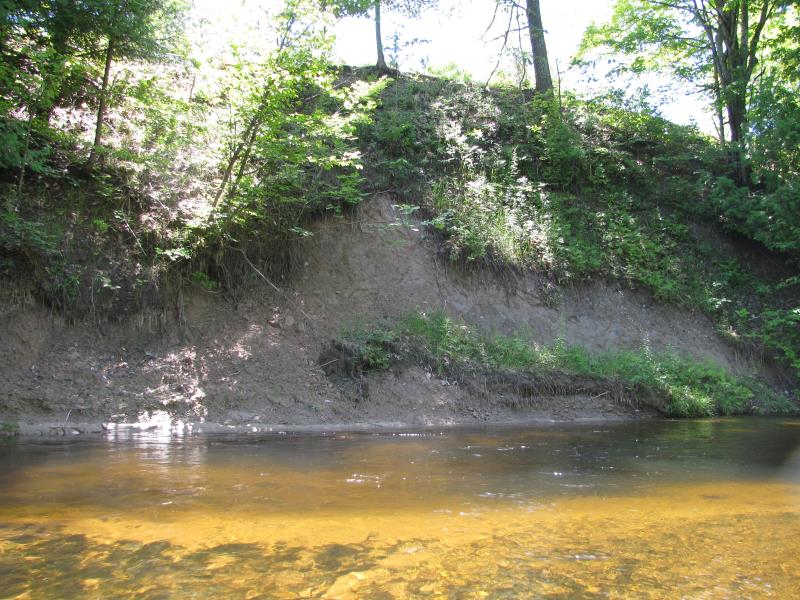
Bank Details
Which Bank? Left
Bank Aspect:NW
Condition:Both toe and upper bank eroding
Erosion Trend:Increasing
Percent Veg. Cover: 11-50%
Bank Conditions
Stream Width:20 ft.
Stream Depth:2 ft.
Stream Current:Slow
Eroded Bank Length:45 ft.
Eroded Bank Height:12 ft.
Slope of Eroded Bank:1:1
Texture: Clay
Cause(s) of Erosion
-Bend in river
Recommended Treatment(s)
-Rock riprap
-Tree revetments
General Information
Total Points
31
�