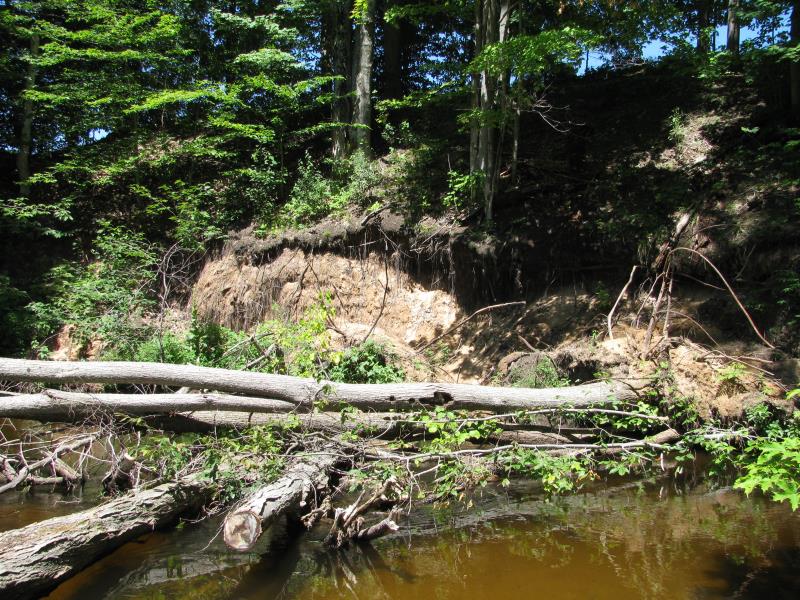
Stream Bank Erosion Site BTS-019
Total Severity: Moderate
Total Points: 26
Information collected by:
Betsie River Watershed,
Betsie River
Colfax Twp,
Benzie County
GPS Coordinates: 44.55001
, -85.93332
T25N
R13W
Sec 19
Owned by Private
Bank Details
Which Bank? Right
Bank Aspect:S
Condition:Toe is stable upper bank eroding
Erosion Trend:Increasing
Percent Veg. Cover: 11-50%
Bank Conditions
Stream Width:25 ft.
Stream Depth:2 ft.
Stream Current:Slow
Eroded Bank Length:50 ft.
Eroded Bank Height:10 ft.
Slope of Eroded Bank:1:1
Texture: Sand
Cause(s) of Erosion
-Bend in river
Other causes: Trees fell.
Recommended Treatment(s)
-Rock riprap
-Tree revetments
General Information
Total Points
26
�