Stream Bank Erosion Site BTS-025
Total Severity: Severe
Total Points: 35
Information collected by:
Betsie River Watershed,
Betsie River
Weldon Twp,
Benzie County
GPS Coordinates: 44.53308
, -85.94719
T25N
R14W
Sec 25
Owned by Private
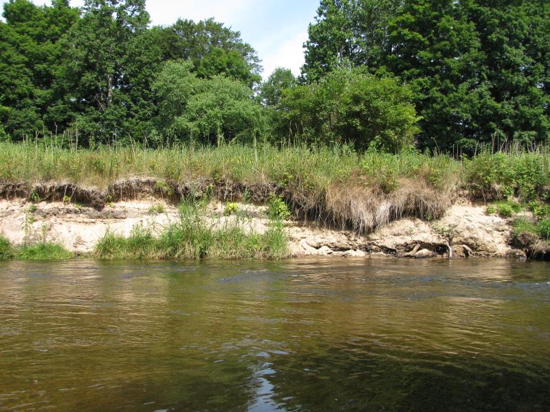
Bank Details
Which Bank? Right
Bank Aspect:S
Condition:Both toe and upper bank eroding
Erosion Trend:Increasing
Percent Veg. Cover: 0-10%
Bank Conditions
Stream Width:40 ft.
Stream Depth:1 ft.
Stream Current:Fast
Eroded Bank Length:100 ft.
Eroded Bank Height:4 ft.
Slope of Eroded Bank:1:1
Texture: Sand
Cause(s) of Erosion
-Bend in river
Other causes: Old Impoundment.
Recommended Treatment(s)
-Bank revegetation
Other Treatments:Create floodplain.
General Information
Total Points
35
�