Stream Bank Erosion Site BTS-038
Total Severity: Severe
Total Points: 35
Information collected by:
Betsie River Watershed,
Betsie River
Springdale Twp,
Manistee County
GPS Coordinates: 44.50987
, -85.95992
T24N
R14W
Sec 2
Owned by Private
Site Access:Accessible by Road (.1 miles)
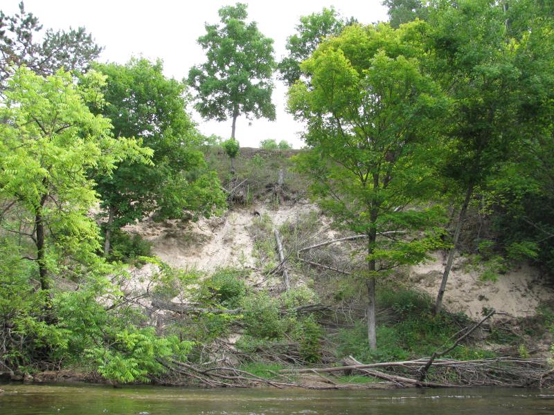
Bank Details
Which Bank? Left
Bank Aspect:NW
Condition:Toe is stable; upper bank eroding
Erosion Trend:Increasing
Percent Veg. Cover: 11-50%
Bank Conditions
Stream Width:35 ft.
Stream Depth:2 ft.
Stream Current:Fast
Eroded Bank Length:60 ft.
Eroded Bank Height:40 ft.
Slope of Eroded Bank:1:1
Texture: Sand
Cause(s) of Erosion
-Bend in river
Recommended Treatment(s)
-Bank revegetation
Other Treatments:Possibly terrace up bank.
General Information
Large site extending downstream.
Total Points
35
�