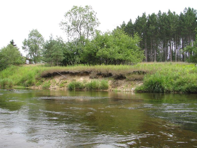
Stream Bank Erosion Site BTS-039
Total Severity: Moderate
Total Points: 30
Information collected by:
Betsie River Watershed,
Betsie River
Springdale Twp,
Manistee County
GPS Coordinates: 44.50682
, -85.97011
T24N
R14W
Sec 2
Owned by Private
Bank Details
Which Bank? Left
Bank Aspect:N
Condition:Both toe and upper bank eroding
Erosion Trend:Increasing
Percent Veg. Cover: 11-50%
Bank Conditions
Stream Width:40 ft.
Stream Depth:3 ft.
Stream Current:Slow
Eroded Bank Length:40 ft.
Eroded Bank Height:4 ft.
Slope of Eroded Bank:1.5:1
Texture: Sand
Cause(s) of Erosion
-Foot traffic
Recommended Treatment(s)
-Bank revegetation
-Rock riprap
-Tree revetments
General Information
Buried cable/wiring evident. Orsini hatchery adjacent to site.
Total Points
30
�