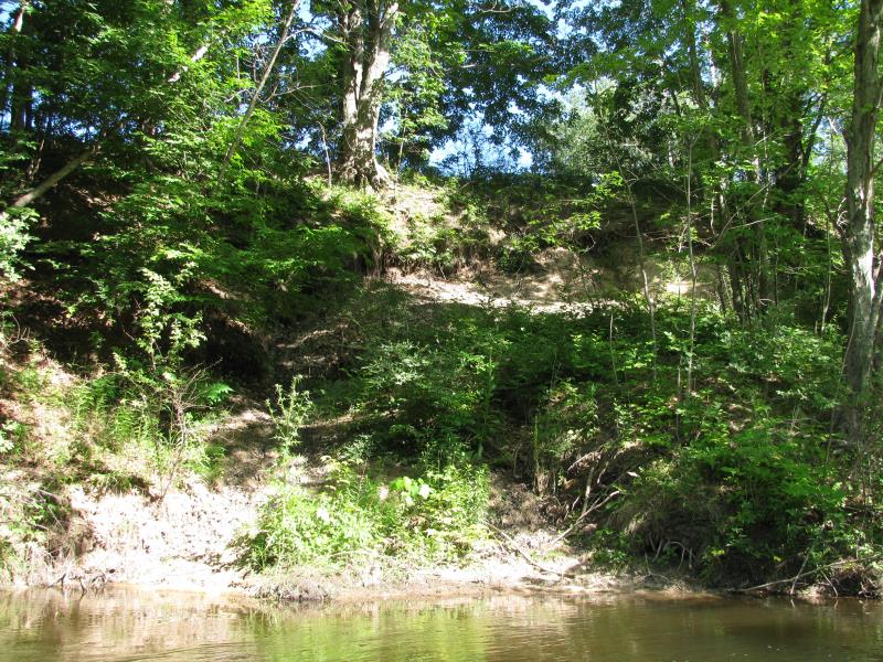
Stream Bank Erosion Site BTS-045
Total Severity: Minor
Total Points: 27
Information collected by:
Betsie River Watershed,
Betsie River
Springdale Twp,
Manistee County
GPS Coordinates: 44.50136
, -85.98477
T24N
R14W
Sec 3
Owned by Private
Bank Details
Which Bank? Right
Bank Aspect:SE
Condition:Both toe and upper bank eroding
Erosion Trend:Stable
Percent Veg. Cover: 51-100%
Bank Conditions
Stream Width:15 ft.
Stream Depth:5 ft.
Stream Current:Fast
Eroded Bank Length:50 ft.
Eroded Bank Height:20 ft.
Slope of Eroded Bank:2:1
Texture: Clay
Cause(s) of Erosion
Other causes: Tree slump.
Recommended Treatment(s)
-Bank revegetation
-Tree revetments
General Information
Total Points
27
�