Stream Bank Erosion Site BTS-068
Total Severity: Severe
Total Points: 33
Information collected by:
Betsie River Watershed,
Betsie River
Weldon Twp,
Benzie County
GPS Coordinates: 44.53567
, -86.05403
T25N
R14W
Sec 30
Owned by Private
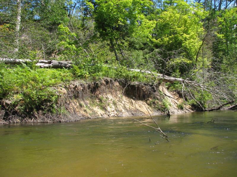
Bank Details
Which Bank? Right
Bank Aspect:SW
Condition:Both toe and upper bank eroding
Erosion Trend:Increasing
Percent Veg. Cover: 11-50%
Bank Conditions
Stream Width:25 ft.
Stream Depth:3 ft.
Stream Current:Fast
Eroded Bank Length:50 ft.
Eroded Bank Height:10 ft.
Slope of Eroded Bank:1:1
Texture: Sand over clay
Cause(s) of Erosion
-Bank seepage
Recommended Treatment(s)
-Bank revegetation
-Tree revetments
General Information
Major slump in adjacent upland area.
Total Points
33
�