Stream Bank Erosion Site BTS-087
Total Severity: Moderate
Total Points: 29
Information collected by:
Betsie River Watershed,
Betsie River
Benzonia Twp,
Benzie County
GPS Coordinates: 44.60627
, -86.11302
T26N
R15W
Sec 34
Owned by State
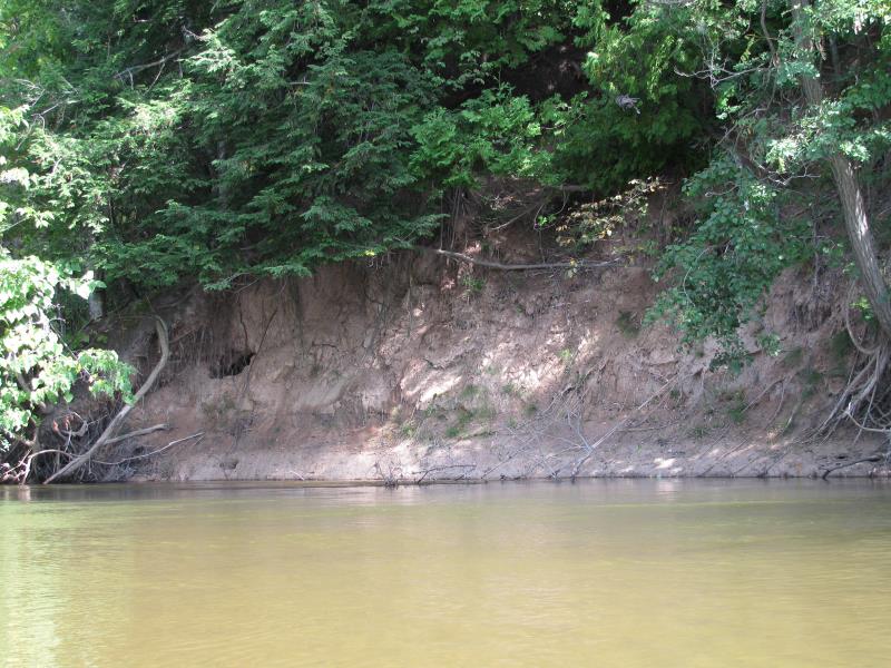
Bank Details
Which Bank? Right
Bank Aspect:SW
Condition:Toe is eroding
Erosion Trend:Increasing
Percent Veg. Cover: 10-50%
Bank Conditions
Stream Width:35 ft.
Stream Depth:1 ft.
Stream Current:Slow
Eroded Bank Length:50 ft.
Eroded Bank Height:15 ft.
Slope of Eroded Bank:1:1
Texture: Clay
Cause(s) of Erosion
-Bend in river
Recommended Treatment(s)
-Tree revetments
General Information
Total Points
29
�