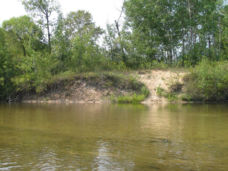
Stream Bank Erosion Site BTS-079
Total Severity: Moderate
Total Points: 31
Information collected by:
Betsie River Watershed,
Betsie River
Benzonia Twp,
Benzie County
GPS Coordinates: 44.59577
, -86.07784
T25N
R15W
Sec 1
Owned by Private
Bank Details
Which Bank? Right
Bank Aspect:SE
Condition:Both toe and upper bank eroding
Erosion Trend:Increasing
Percent Veg. Cover: 0-10%
Bank Conditions
Stream Width:90 ft.
Stream Depth:1 ft.
Stream Current:Slow
Eroded Bank Length:40 ft.
Eroded Bank Height:10 ft.
Slope of Eroded Bank:1:1
Texture: Sand over clay
Cause(s) of Erosion
-Bend in river
-Foot traffic
Recommended Treatment(s)
-Bank revegetation
-Tree revetments
-Constructed access
General Information
Total Points
31
�