Stream Bank Erosion Site AUS-SB16
Total Severity: Moderate
Total Points: 31
Information collected by:
Au Sable River Watershed,
South Branch Au Sable River
Higgins Twp,
Roscommon County
GPS Coordinates: 44.4941
, -84.5105
T24N
R2W
Sec 12
Owned by Private
Site Access:20
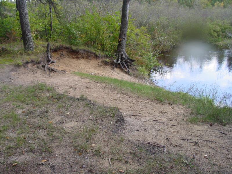
Bank Details
Which Bank? Right
Condition:Both toe and upper bank eroding
Erosion Trend:Increasing
Percent Veg. Cover: 11-50%
Bank Conditions
Stream Width:15 ft.
Stream Depth:2 ft.
Stream Current:Slow
Eroded Bank Length:25 ft.
Eroded Bank Height:8 ft.
Slope of Eroded Bank:2:1
Texture: Sand Over Clay"
Cause(s) of Erosion
-Bend in river
-Foot traffic
Other causes: Canoe access
Recommended Treatment(s)
-Bank revegetation
-Tree revetments
-Constructed access
General Information
BMPs Completed:
Fencing
Total Points
31
�