Stream Bank Erosion Site AUS-SB23
Total Severity: Minor
Total Points: 27
Information collected by:
Au Sable River Watershed,
South Branch Au Sable River
Higgins Twp,
Roscommon County
GPS Coordinates: 44.49347
, -84.52861
T24N
R2W
Sec 11
Owned by Private
Site Access:unknown
Bank Details
Which Bank? Right
Bank Aspect:North
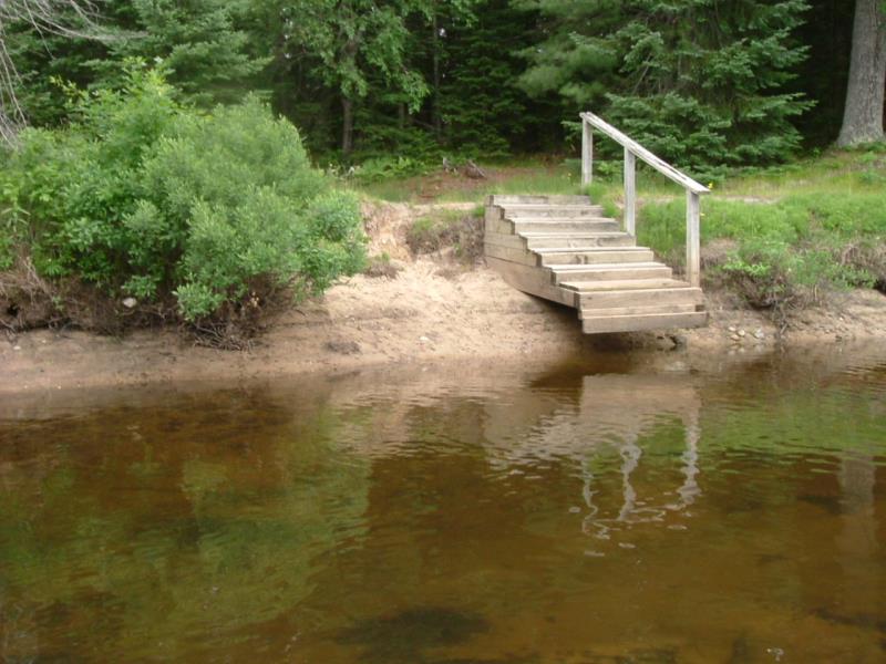
Condition:Both toe and upper bank eroding
Erosion Trend:Increasing
Percent Veg. Cover: 11-50%
Bank Conditions
Stream Width:40 ft.
Stream Depth:2 ft.
Stream Current:Slow
Eroded Bank Length:20 ft.
Eroded Bank Height:3 ft.
Slope of Eroded Bank:3:1
Texture: Sand
Cause(s) of Erosion
-Bend in river
-Foot traffic
Other causes: Riverbank has eroded from under steps
Recommended Treatment(s)
-Cover structure
General Information
Total Points
27
�