Stream Bank Erosion Site AUS-SB31
Total Severity: Moderate
Total Points: 35
Information collected by:
Au Sable River Watershed,
South Branch Au Sable River
South Branch Twp,
Crawford County
GPS Coordinates: 44.51491
, -84.59245
T25N
R2W
Sec 31
Owned by State
Site Access:100
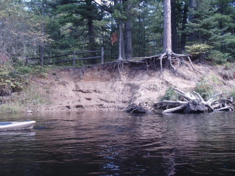
Bank Details
Which Bank? Right
Bank Aspect:East
Condition:Both toe and upper bank eroding
Erosion Trend:Increasing
Percent Veg. Cover: 11-50%
Bank Conditions
Stream Width:40 ft.
Stream Depth:2 ft.
Stream Current:Slow
Eroded Bank Length:90 ft.
Eroded Bank Height:20 ft.
Slope of Eroded Bank:1:1
Texture: Sand
Cause(s) of Erosion
-Foot traffic
Other causes: Mostly a steep exposed high sandy bank
Recommended Treatment(s)
-Bank revegetation
-Cover structure
General Information
Total Points
35
�