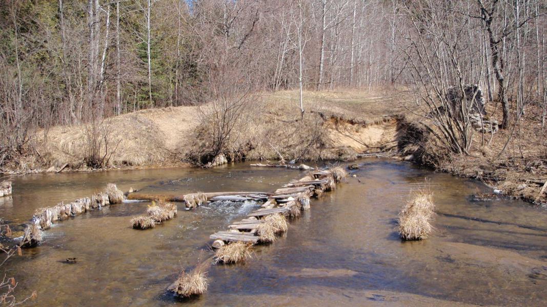
Stream Bank Erosion Site AUS-MS003
Total Severity: Severe
Total Points: 36
Information collected by:
Au Sable River Watershed,
Au Sable River
Frederic Twp,
Crawford County
GPS Coordinates: 44.77568
, -84.76593
T28N
R4W
Sec 35
Owned by State
Site Access:Road on both sides of river
Bank Details
Which Bank? Left
Condition:Both toe and upper bank eroding
Erosion Trend:Increasing
Percent Veg. Cover: 11-50%
Bank Conditions
Stream Width:60 ft.
Stream Depth:3 ft.
Stream Current:Fast
Eroded Bank Length:45 ft.
Eroded Bank Height:6 ft.
Slope of Eroded Bank:1:1
Texture: Sand
Cause(s) of Erosion
-Obstructions in river
-Bank seepage
-Foot traffic
Other causes: Log pilings from former dam at site
Recommended Treatment(s)
-Obstruction removal
-Bank revegetation
-Rock riprap
-Cover structure
General Information
BMPs Completed:
Fencing
Total Points
36
�