Stream Bank Erosion Site AUS-LZ1
Total Severity: Minor
Total Points: 28
Information collected by:
Au Sable River Watershed,
Big Creek
Big Creek Twp,
Oscoda County
GPS Coordinates: 44.63769
, -84.26114
T26N
R1E
Sec 24
Owned by County
Site Access:Site at county road bridge
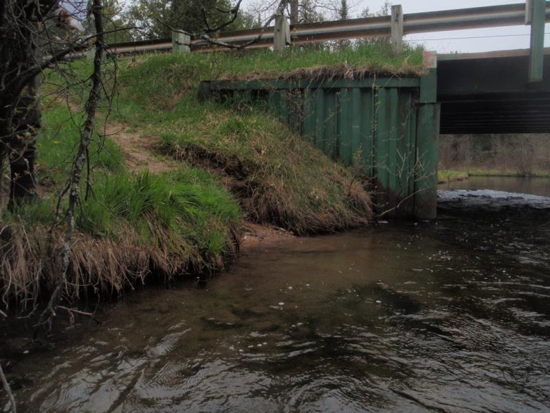
Bank Details
Which Bank? Right
Condition:Both toe and upper bank eroding
Erosion Trend:Increasing
Percent Veg. Cover: 0-10%
Bank Conditions
Stream Width:37 ft.
Stream Depth:2 ft.
Stream Current:Fast
Eroded Bank Length:4 ft.
Eroded Bank Height:4 ft.
Slope of Eroded Bank:2:1
Texture: Sand
Cause(s) of Erosion
-Foot traffic
Recommended Treatment(s)
-Rock riprap
-Constructed access
General Information
Total Points
28
�