Stream Bank Erosion Site AUS-LZ2
Total Severity: Minor
Total Points: 29
Information collected by:
Au Sable River Watershed,
Big Creek
Big Creek Twp,
Oscoda County
GPS Coordinates: 44.66056
, -84.26067
T26N
R1E
Sec 13
Owned by Private
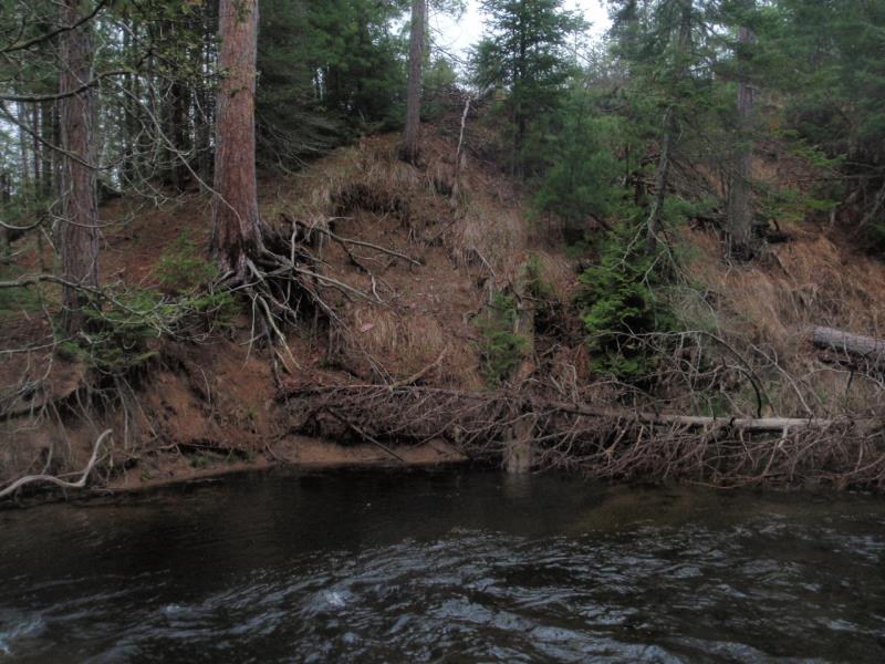
Bank Details
Which Bank? Right
Condition:Both toe and upper bank eroding
Erosion Trend:Stable
Percent Veg. Cover: 51-100%
Bank Conditions
Stream Width:30 ft.
Stream Depth:3 ft.
Stream Current:Fast
Eroded Bank Length:40 ft.
Eroded Bank Height:30 ft.
Slope of Eroded Bank:1:1
Texture: Loam
Cause(s) of Erosion
-Bend in river
-Bank seepage
Recommended Treatment(s)
-Bank revegetation
-Tree revetments
General Information
Total Points
29
�