Stream Bank Erosion Site AUS-MS009
Total Severity: Minor
Total Points: 29
Information collected by:
Au Sable River Watershed,
Au Sable River
Grayling,
Crawford County
GPS Coordinates: 44.66779
, -84.6777
T26N
R3W
Sec 9
Owned by State
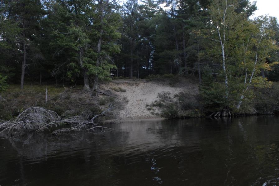
Bank Details
Which Bank? Left
Condition:Both toe and upper bank eroding
Erosion Trend:Increasing
Percent Veg. Cover: 0-10%
Bank Conditions
Stream Width:45 ft.
Stream Depth:1.5 ft.
Stream Current:Slow
Eroded Bank Length:12 ft.
Eroded Bank Height:10 ft.
Slope of Eroded Bank:1:1
Texture: Sand
Cause(s) of Erosion
-Foot traffic
Recommended Treatment(s)
-Bank revegetation
-Tree revetments
General Information
Total Points
29
�