Stream Bank Erosion Site AUS-MS025
Total Severity: Minor
Total Points: 27
Information collected by:
Au Sable River Watershed,
Au Sable River
South Branch Twp,
Crawford County
GPS Coordinates: 44.66733
, -84.38583
T26N
R1W
Sec 12
Owned by Federal
Site Access:0.1 mi
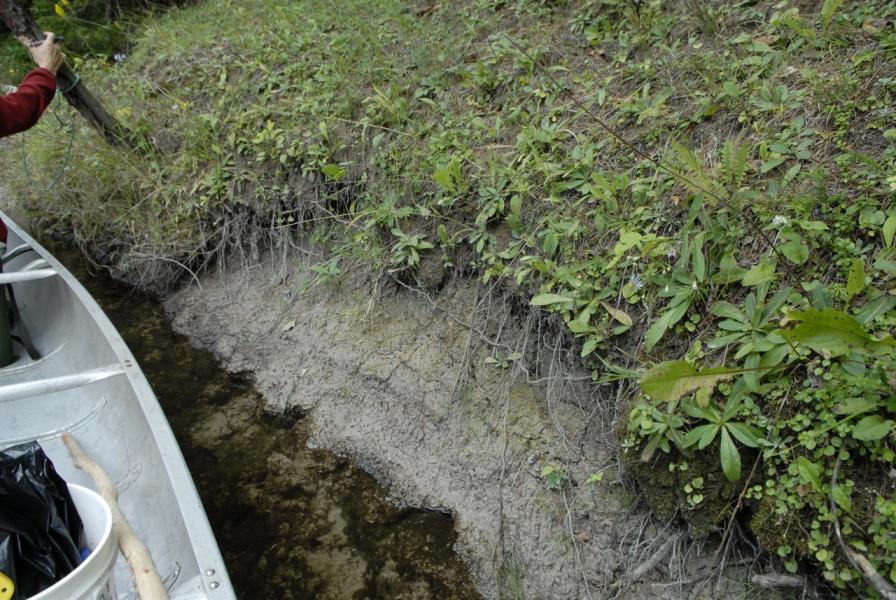
Bank Details
Which Bank? Right
Condition:Both toe and upper bank eroding
Erosion Trend:Increasing
Percent Veg. Cover: 0-10%
Bank Conditions
Stream Width:40 ft.
Stream Depth:2.5 ft.
Stream Current:Fast
Eroded Bank Length:20 ft.
Eroded Bank Height:2 ft.
Slope of Eroded Bank:2:1
Texture: Clay
Cause(s) of Erosion
-Bend in river
Other causes: Claybank calving
Recommended Treatment(s)
-Cover structure
General Information
Total Points
27
�