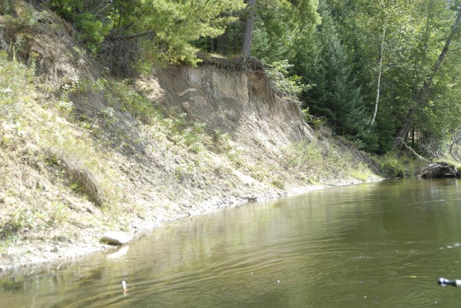
Stream Bank Erosion Site AUS-MS030
Total Severity: Moderate
Total Points: 34
Information collected by:
Au Sable River Watershed,
Au Sable River
South Branch Twp,
Crawford County
GPS Coordinates: 44.67233
, -84.372
T26N
R1W
Sec 1
Owned by Private
Bank Details
Which Bank? Left
Condition:Both toe and upper bank eroding
Erosion Trend:Increasing
Percent Veg. Cover: 0-10%
Bank Conditions
Stream Width:40 ft.
Stream Depth:4 ft.
Stream Current:Fast
Eroded Bank Length:150 ft.
Eroded Bank Height:15 ft.
Slope of Eroded Bank:1:1
Texture: Clay
Cause(s) of Erosion
Other causes: Clay bank calving
Recommended Treatment(s)
-Cover structure
General Information
Total Points
34
�