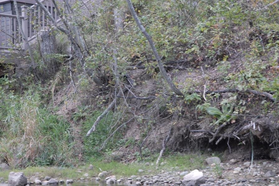
Stream Bank Erosion Site AUS-MS038
Total Severity: Moderate
Total Points: 30
Information collected by:
Au Sable River Watershed,
Au Sable River
Big Creek Twp,
Oscoda County
GPS Coordinates: 44.67463
, -84.29632
T26N
R1E
Sec 3
Owned by Private
Site Access:Site just downstream of cabin
Bank Details
Which Bank? Left
Condition:Toe is stable; upper bank eroding
Erosion Trend:Increasing
Percent Veg. Cover: 11-50%
Bank Conditions
Stream Width:100 ft.
Stream Depth:1 ft.
Stream Current:Fast
Eroded Bank Length:20 ft.
Eroded Bank Height:10 ft.
Slope of Eroded Bank:3:1
Texture: Sand
Cause(s) of Erosion
-Foot traffic
Recommended Treatment(s)
-Tree revetments
-Constructed access
General Information
BMPs Completed:
Fencing
Total Points
30
�