Stream Bank Erosion Site AUS-MS047
Total Severity: Severe
Total Points: 37
Information collected by:
Au Sable River Watershed,
Au Sable River
Mentor Twp,
Oscoda County
GPS Coordinates: 44.65526
, -84.10325
T26N
R3E
Sec 8
Owned by Federal
Bank Details
Which Bank? Left
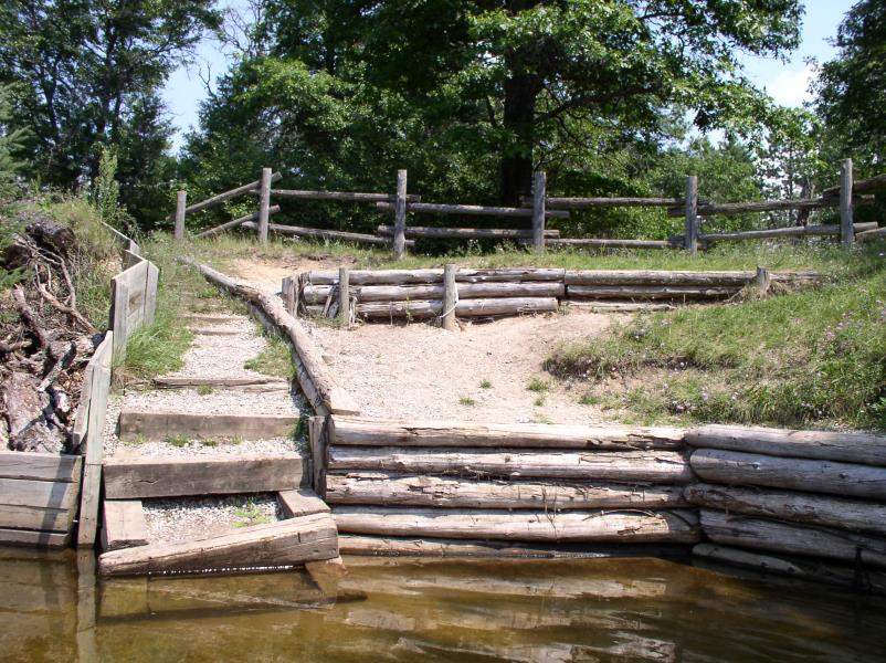
Condition:Toe is undercutting
Erosion Trend:Increasing
Percent Veg. Cover: 0-10%
Bank Conditions
Stream Width:120 ft.
Stream Depth:1 ft.
Stream Current:Fast
Eroded Bank Length:30 ft.
Eroded Bank Height:15 ft.
Slope of Eroded Bank:1:1
Texture: Sand
Cause(s) of Erosion
-Foot traffic
Other causes: Repair needed on steps
Recommended Treatment(s)
General Information
Total Points
37
�