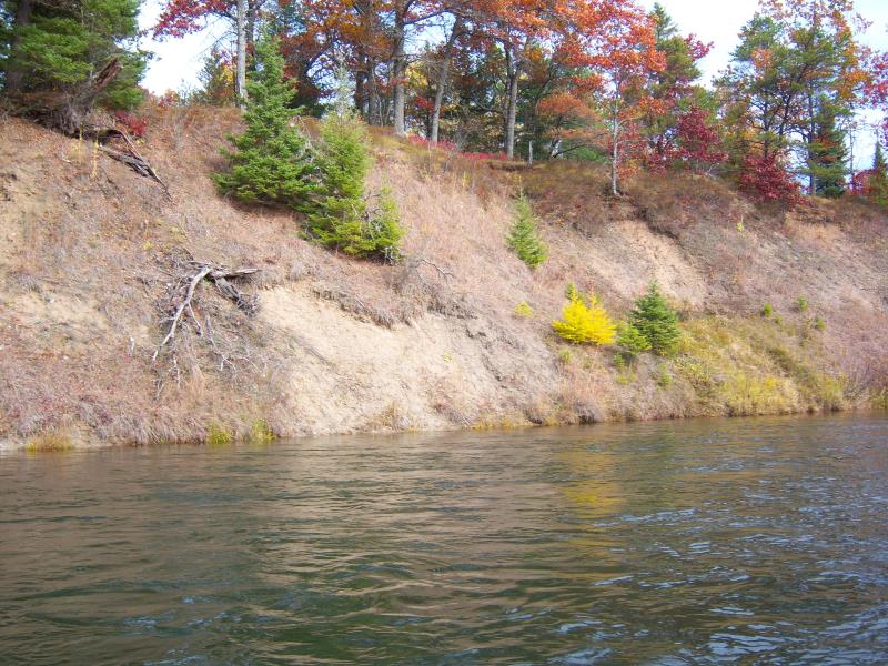
Stream Bank Erosion Site AUS-MS061
Total Severity: Minor
Total Points: 23
Information collected by:
Au Sable River Watershed,
Au Sable River
Mentor Twp,
Oscoda County
GPS Coordinates: 44.65264
, -83.9793
T26N
R3E
Sec 17
Owned by Federal
Bank Details
Which Bank? Left
Bank Aspect:South
Condition:Toe is stable; upper bank eroding
Erosion Trend:Stable
Percent Veg. Cover: 51-100%
Bank Conditions
Stream Width:75 ft.
Stream Depth:1 ft.
Stream Current:Fast
Eroded Bank Length:25 ft.
Eroded Bank Height:25 ft.
Slope of Eroded Bank:2:1
Texture: Sand
Cause(s) of Erosion
-Bend in river
Recommended Treatment(s)
-Bank revegetation
-Cover structure
General Information
Total Points
23
�