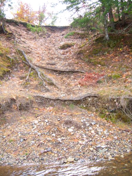
Stream Bank Erosion Site AUS-MS069
Total Severity: Moderate
Total Points: 33
Information collected by:
Au Sable River Watershed,
Au Sable River
Mitchell Twp,
Alcona County
GPS Coordinates: 44.63375
, -83.87837
T26N
R5E
Sec 19
Owned by Federal
Bank Details
Which Bank? Right
Bank Aspect:North
Condition:Both toe and upper bank eroding
Erosion Trend:Increasing
Percent Veg. Cover: 0-10%
Bank Conditions
Stream Width:100 ft.
Stream Depth:1 ft.
Stream Current:Slow
Eroded Bank Length:10 ft.
Eroded Bank Height:50 ft.
Slope of Eroded Bank:2:1
Texture: Sand
Cause(s) of Erosion
-Foot traffic
Recommended Treatment(s)
-Bank revegetation
-Cover structure
-Tree revetments
-Constructed access
General Information
Total Points
33
�