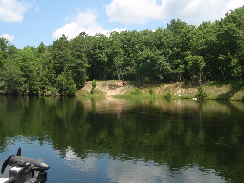
Stream Bank Erosion Site AUS-MS095
Total Severity: Minor
Total Points: 20
Information collected by:
Au Sable River Watershed,
Au Sable River
Oscoda Twp,
Iosco County
GPS Coordinates: 44.44925
, -83.66991
T24N
R6E
Sec 23
Owned by Federal
Bank Details
Which Bank? Left
Bank Aspect:East side of river
Condition:Toe is stable; upper bank eroding
Erosion Trend:Increasing
Percent Veg. Cover: 11-50%
Bank Conditions
Stream Width:200 ft.
Stream Depth:3 ft.
Stream Current:Slow
Eroded Bank Length:50 ft.
Eroded Bank Height:10 ft.
Slope of Eroded Bank:2:1
Texture: Gravel
Cause(s) of Erosion
-Bank seepage
-Foot traffic
Other causes: Canoe campers
Recommended Treatment(s)
-Bank revegetation
-Rock riprap
-Tree revetments
General Information
Total Points
20
�