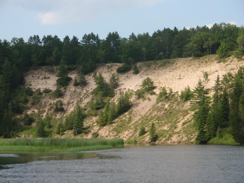
Stream Bank Erosion Site AUS-MS106
Total Severity: Severe
Total Points: 39
Information collected by:
Au Sable River Watershed,
Au Sable River
Oscoda Twp,
Iosco County
GPS Coordinates: 44.47195
, -83.5598
T24N
R7E
Sec 14
Owned by Federal
Bank Details
Which Bank? Left
Condition:Both toe and upper bank eroding
Erosion Trend:Increasing
Percent Veg. Cover: 0-10%
Bank Conditions
Stream Width:90 ft.
Stream Depth:1 ft.
Stream Current:Slow
Eroded Bank Length:200 ft.
Eroded Bank Height:120 ft.
Slope of Eroded Bank:1:1
Texture: Sand
Cause(s) of Erosion
Other causes: Steep sandy bank too dry and toe is eroding due to wave action
Recommended Treatment(s)
-Bank revegetation
-Tree revetments
General Information
Total Points
39
�