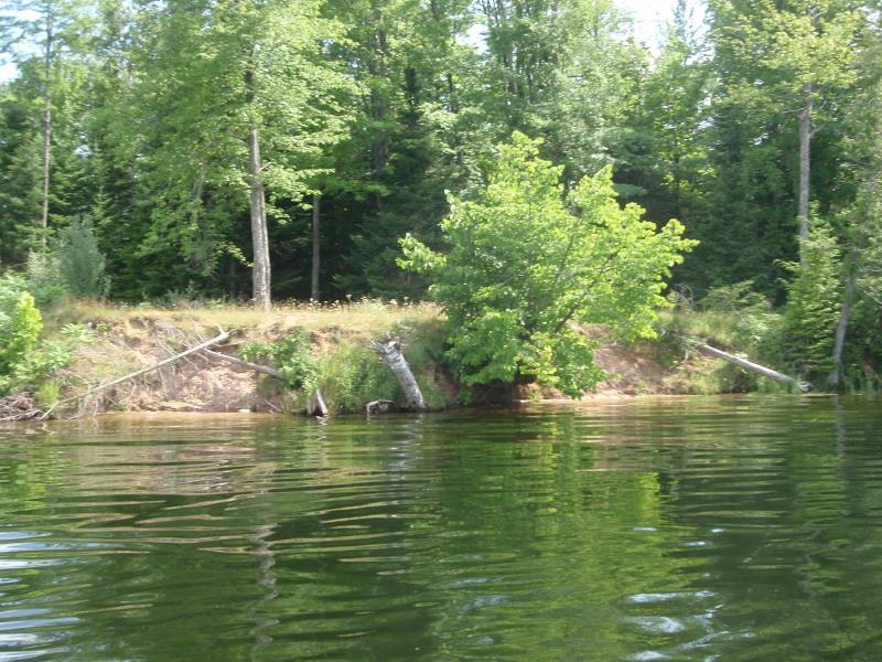
Stream Bank Erosion Site AUS-MS112
Total Severity: Moderate
Total Points: 30
Information collected by:
Au Sable River Watershed,
Au Sable River
Oscoda Twp,
Iosco County
GPS Coordinates: 44.46511
, -83.55031
T24N
R7E
Sec 23
Owned by Federal
Bank Details
Which Bank? Right
Condition:Both toe and upper bank eroding
Erosion Trend:Increasing
Percent Veg. Cover: 0-10%
Bank Conditions
Stream Width:100 ft.
Stream Depth:3 ft.
Stream Current:Slow
Eroded Bank Length:25 ft.
Eroded Bank Height:10 ft.
Slope of Eroded Bank:1:1
Texture: Sand
Cause(s) of Erosion
Other causes: Wave action on steep sand bank
Recommended Treatment(s)
-Bank revegetation
-Tree revetments
General Information
Total Points
30
�