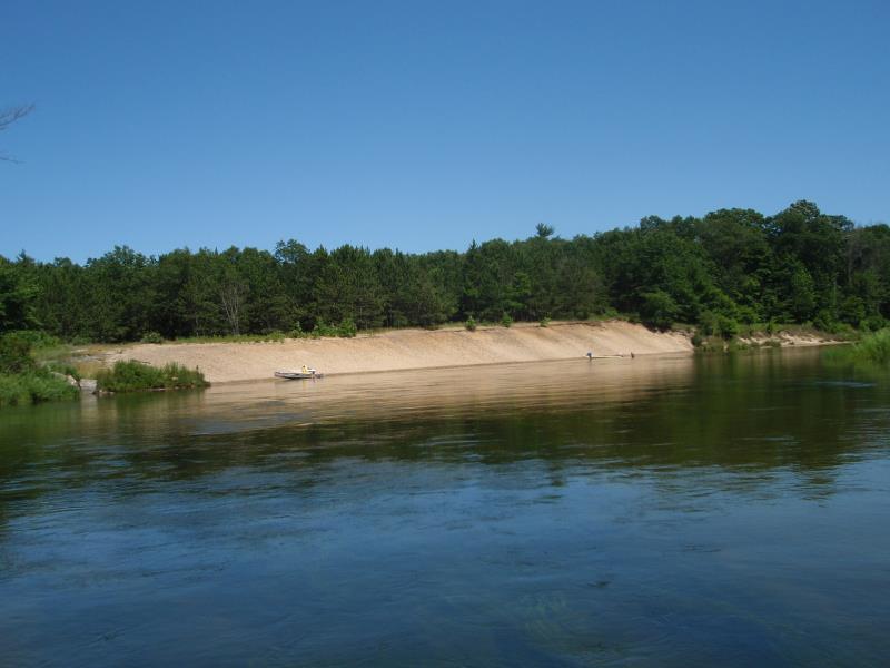
Stream Bank Erosion Site AUS-MS150
Total Severity: Minor
Total Points: 29
Information collected by:
Au Sable River Watershed,
Au Sable River
Oscoda Twp,
Iosco County
GPS Coordinates: 44.43435
, -83.36346
T24N
R9E
Sec 32
Owned by Federal
Bank Details
Which Bank? Left
Condition:Toe is stable; upper bank eroding
Erosion Trend:Increasing
Percent Veg. Cover: 0-10%
Bank Conditions
Stream Width:200 ft.
Stream Depth:3 ft.
Stream Current:Slow
Eroded Bank Length:300 ft.
Eroded Bank Height:8 ft.
Slope of Eroded Bank:2:1
Texture: Sand
Cause(s) of Erosion
-Foot traffic
Other causes: Boat stop
Recommended Treatment(s)
-Bank revegetation
-Tree revetments
General Information
Total Points
29
�