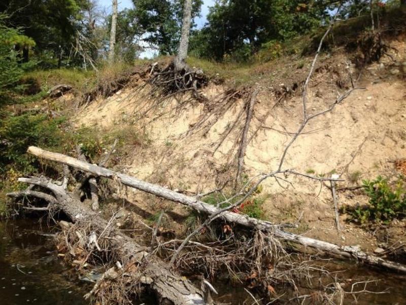
Stream Bank Erosion Site AUS-MS159
Total Severity: Minor
Total Points: 27
Information collected by:
Au Sable River Watershed,
Au Sable River
Big Creek Twp,
Oscoda County
GPS Coordinates: 44.676618
, -84.291465
T26N
R1E
Sec 2
Owned by State
Site Access:100 ft
Bank Details
Which Bank? Left
Condition:Toe is stable; upper bank eroding
Erosion Trend:Decreasing (annuals growing)
Percent Veg. Cover: 11-50%
Bank Conditions
Stream Width:50 ft.
Stream Depth:1.5 ft.
Stream Current:Slow
Eroded Bank Length:60 ft.
Eroded Bank Height:12 ft.
Slope of Eroded Bank:1:1
Texture: Sand
Cause(s) of Erosion
-Bend in river
Recommended Treatment(s)
-Bank revegetation
-Cover structure
General Information
Total Points
27
�