Stream Bank Erosion Site AUS-MS163
Total Severity: Moderate
Total Points: 30
Information collected by:
Au Sable River Watershed,
Au Sable River
Big Creek Twp,
Oscoda County
GPS Coordinates: 44.672887
, -84.265409
T26N
R1E
Sec 1
Owned by Private
Site Access:200 ft
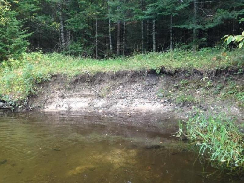
Bank Details
Which Bank? Right
Condition:Both toe and upper bank eroding
Erosion Trend:Increasing
Percent Veg. Cover: 0-10%
Bank Conditions
Stream Width:80 ft.
Stream Depth:1 ft.
Stream Current:Slow
Eroded Bank Length:15 ft.
Eroded Bank Height:4 ft.
Slope of Eroded Bank:1:1
Texture: Sand
Cause(s) of Erosion
-Foot traffic
Recommended Treatment(s)
-Cover structure
-Tree revetments
General Information
Total Points
30
�