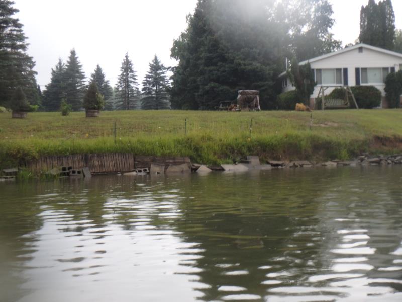
Stream Bank Erosion Site W-01
Total Severity: Minor
Total Points: 21
Information collected by:
Thunder Bay River Watershed,
Thunder Bay River
Maple Ridge Twp,
Alpena County
GPS Coordinates: 45.125525
, -83.613686
T32N
R7E
Sec 32
Site Access:Yes
Bank Details
Which Bank? Left
Bank Aspect:S
Condition:Toe is stable; Upper bank eroding
Erosion Trend:Stable
Percent Veg. Cover: 51-100%
Bank Conditions
Stream Depth:2 ft.
Stream Current:Slow
Eroded Bank Length:60 ft.
Eroded Bank Height:3 ft.
Slope of Eroded Bank:Vertical to 1H:1V
Texture: Sand over clay
Cause(s) of Erosion
Other causes: Mowing/lawn
Recommended Treatment(s)
General Information
Project Details
Year Inventory Completed: 2018
Total Points
21
�