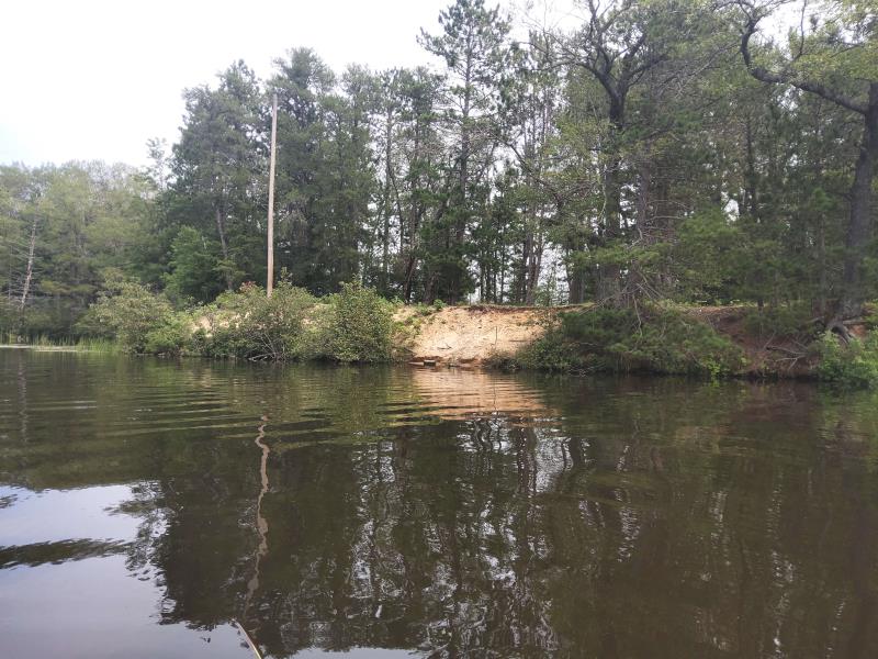
Stream Bank Erosion Site NPS13
Total Severity: Minor
Total Points: 29
Information collected by:
Thunder Bay River Watershed,
Thunder Bay River
Maple Ridge Twp,
Alpena County
GPS Coordinates: 45.0799855819501
, -83.5740763978262
T31N
R7E
Sec 16
Owned by County
Site Access:Yes
Distance to road:10 ft.
2021
Bank Details
Which Bank? Right
Bank Aspect:West
Condition:Toe and upper bank eroding
Erosion Trend:Increasing
Percent Veg. Cover: 11-50%
Bank Conditions
Stream Width:90 ft.
Stream Depth:0.5 ft.
Stream Current:Slow
Eroded Bank Length:50 ft.
Eroded Bank Height:9 ft.
Slope of Eroded Bank:2H:1V
Texture: Sand
Cause(s) of Erosion
-Foot traffic
Recommended Treatment(s)
-Constructed access
General Information
Project Details
Year Inventory Completed: 2021
Total Points
29
�