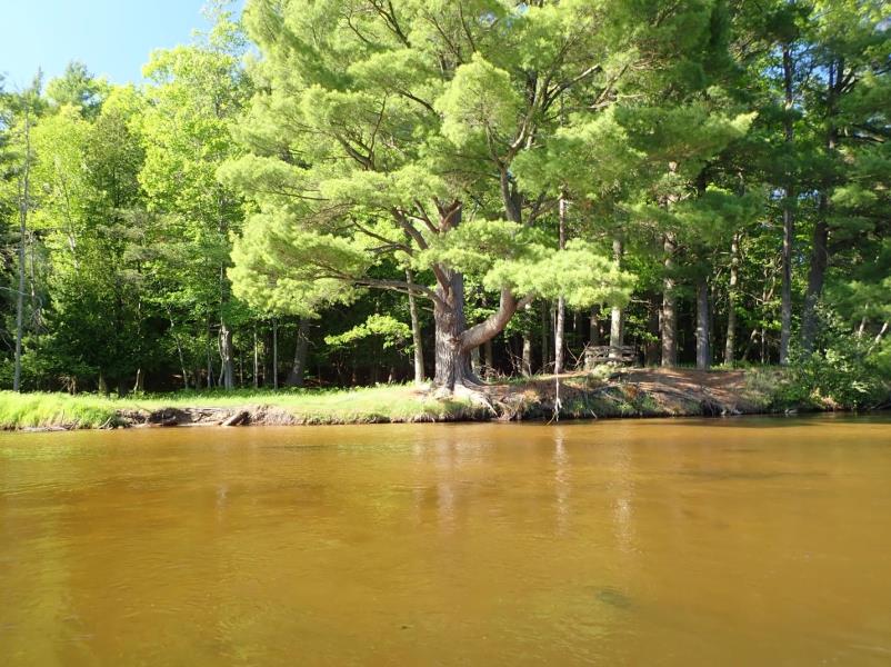
Stream Bank Erosion Site LM#93-2021
Total Severity: Minor
Total Points: 23
Information collected by:
Little Manistee River Watershed,
Little Manistee River
Stronach Twp,
Manistee County
GPS Coordinates: 44.20692
, -86.22277
T21N
R16W
Sec 23
Owned by USFS
2021
Bank Details
Which Bank? Right
Bank Aspect:N
Condition:Toe is undercutting
Erosion Trend:Increasing
Percent Veg. Cover: 50-100%
Bank Conditions
Stream Width:50 ft.
Stream Depth:1 ft.
Stream Current:Medium
Eroded Bank Length:60 ft.
Eroded Bank Height:4 ft.
Slope of Eroded Bank:1:1
Texture: Sand
Cause(s) of Erosion
-Obstructions in river
-Foot traffic
Recommended Treatment(s)
General Information
Project Details
Year Inventory Completed: 2021
Total Points
23
�