Stream Bank Erosion Site BGMN-017
Total Severity: Severe
Total Points: 37
Information collected by:
Big Manistee River Watershed,
Greenwood Twp,
Wexford County
GPS Coordinates: 44.49986
, -85.49728
T24N
R10W
Sec 3
Owned by Private
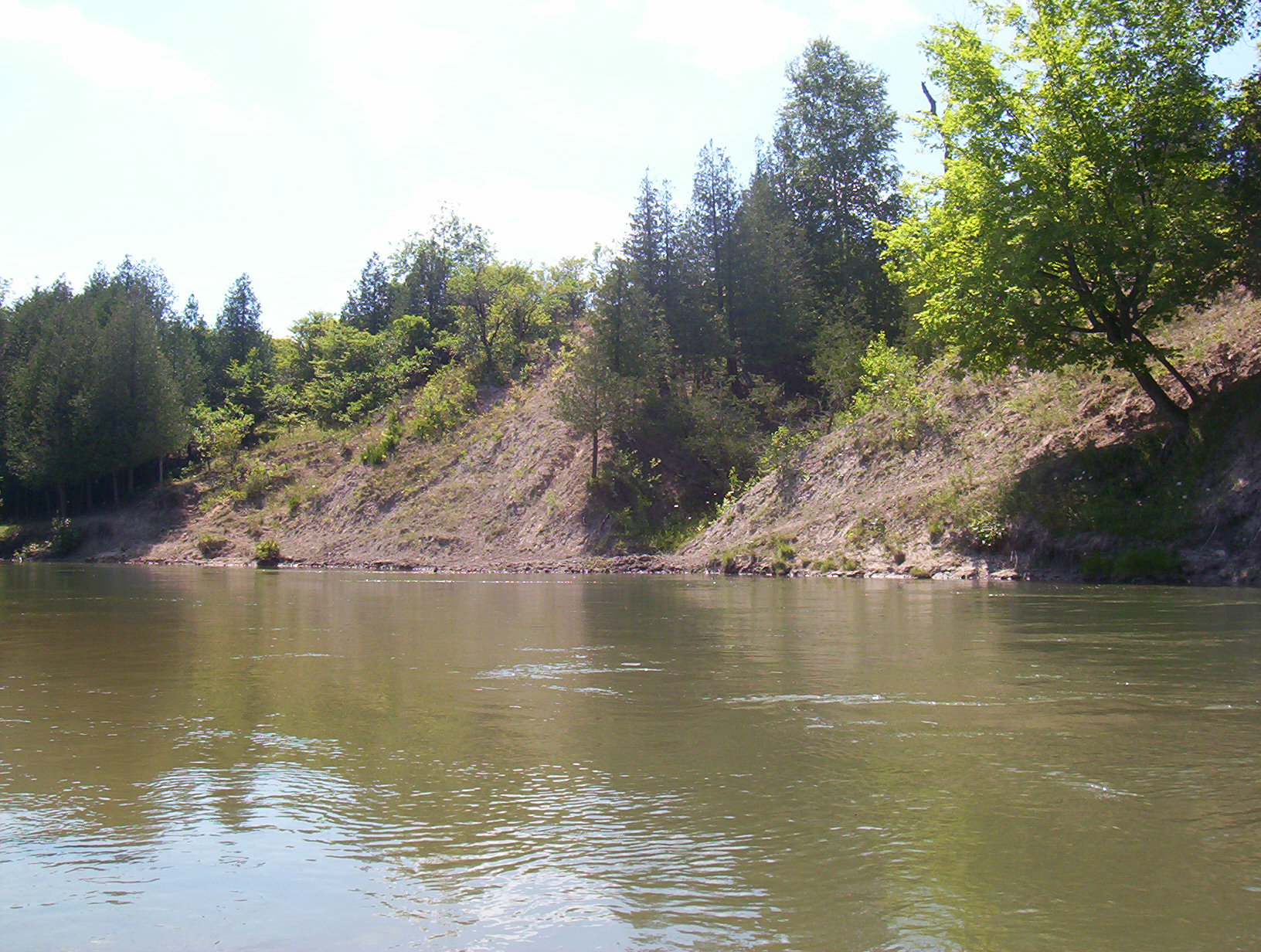
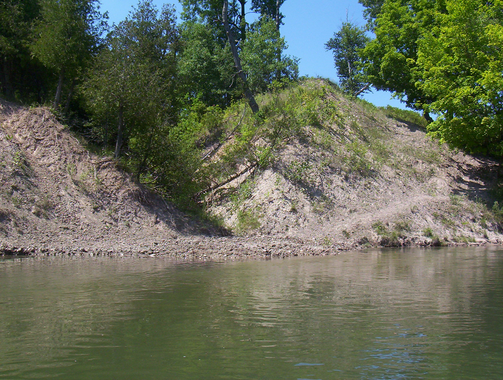
Bank Details
Which Bank? Right
Bank Aspect:SE
Condition:Both toe and upper bank eroding
Erosion Trend:Increasing
Percent Veg. Cover: 0-10%
Bank Conditions
Stream Width:80 ft.
Stream Depth:5 ft.
Stream Current:Fast
Eroded Bank Length:200 ft.
Eroded Bank Height:60 ft.
Slope of Eroded Bank:3:1
Texture: Stratified
Cause(s) of Erosion
-Bank seepage
-Foot traffic
Other causes: Cattle on banks
Recommended Treatment(s)
-Rock riprap
-Tree revetments
-Constructed access
Other Treatments:Keep Cattle Off Banks
General Information
Total Points
37
�