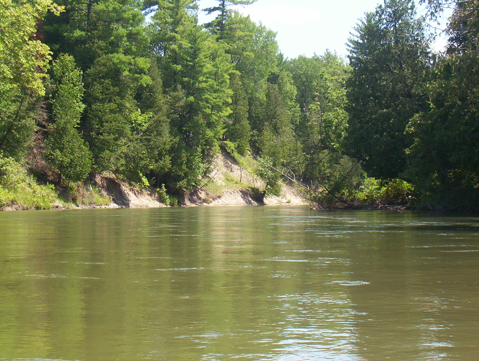
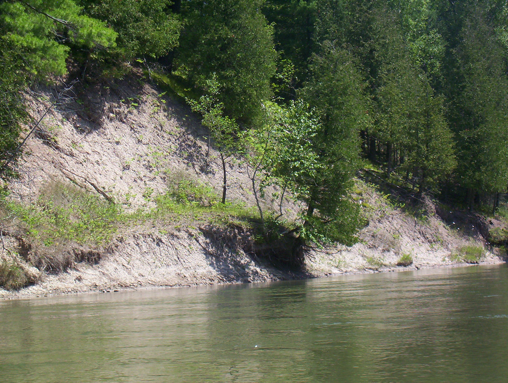
Stream Bank Erosion Site BGMN-018
Total Severity: Moderate
Total Points: 34
Information collected by:
Big Manistee River Watershed,
Greenwood Twp,
Wexford County
GPS Coordinates: 44.49213
, -85.4939
T24N
R10W
Sec 11
Bank Details
Which Bank? Left
Bank Aspect:N
Condition:Both toe and upper bank eroding
Erosion Trend:Increasing
Percent Veg. Cover: 10-50%
Bank Conditions
Stream Width:80 ft.
Stream Depth:6 ft.
Stream Current:Slow
Eroded Bank Length:160 ft.
Eroded Bank Height:35 ft.
Slope of Eroded Bank:3:1
Texture: Clay
Cause(s) of Erosion
-Bank seepage
Recommended Treatment(s)
-Bank revegetation
-Cover structure
-Tree revetments
General Information
Total Points
34
�