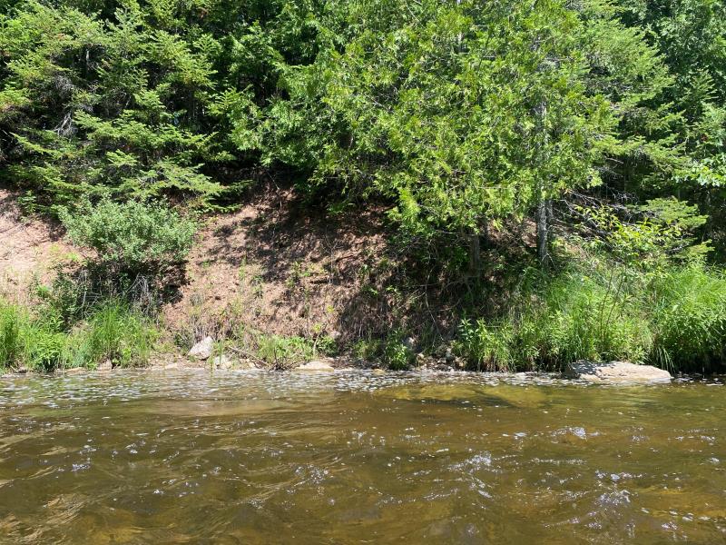
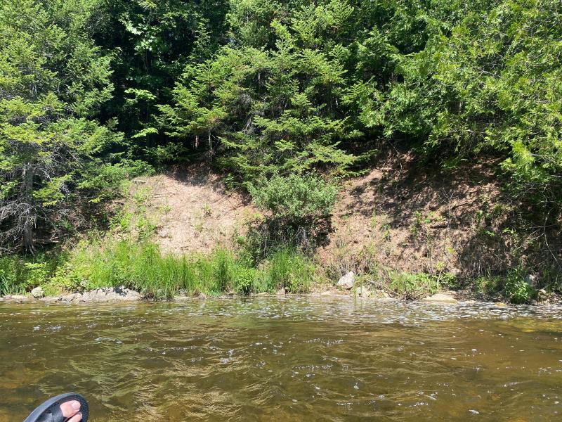
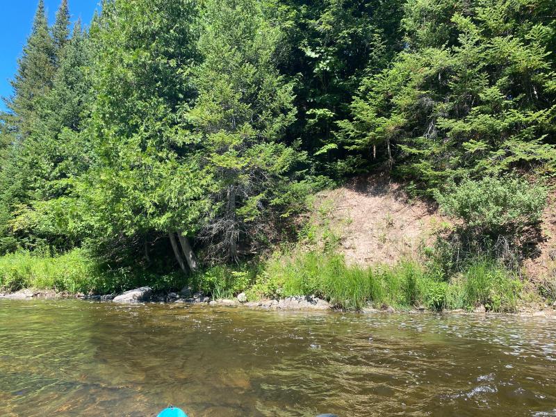
Stream Bank Erosion Site OCR12
Total Severity: Minor
Total Points: 26
Information collected by:
Ocqueoc River Watershed,
Ocqueoc River
Ocqueoc Twp,
Presque Isle County
GPS Coordinates: 45.3905660014347
, -84.0570159478972
T35N
R3E
Sec 27
Owned by State
Site Access:Yes
2022
2022
2022
Bank Details
Which Bank? Right
Bank Aspect:West
Condition:Toe and upper bank eroding
Erosion Trend:Stable
Percent Veg. Cover: 11_50%
Bank Conditions
Stream Width:25 ft.
Stream Depth:3 ft.
Stream Current:Slow
Eroded Bank Length:30 ft.
Eroded Bank Height:10 ft.
Slope of Eroded Bank:Vertical_to_1H:1V
Texture: Clay
Cause(s) of Erosion
-Bend in river
Recommended Treatment(s)
General Information
Project Details
Year Inventory Completed: 2022
Total Points
26
�