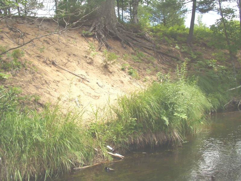
Stream Bank Erosion Site BRD-S414
Total Severity: Severe
Total Points: 39
Information collected by:
Boardman River Watershed,
South Branch Boardman River
Boardman Twp,
Kalkaska County
GPS Coordinates: 44.66228322
, -85.31001309
T26N
R8W
Sec 8
Owned by State
Site Access:Yes - campsite atop bank
Bank Details
Which Bank? Right
Bank Aspect:SW
Condition:Both toe and upper bank eroding
Erosion Trend:Increasing
Percent Veg. Cover: 0-10%
Bank Conditions
Stream Width:24 ft.
Stream Depth:24 in.
Stream Current:Moderate
Eroded Bank Length:80 ft.
Eroded Bank Height:22 ft.
Slope of Eroded Bank:1:1
Texture: Sand
Cause(s) of Erosion
-Foot traffic
Recommended Treatment(s)
-Bank revegetation
-Rock riprap
-Cover structure
-Tree revetments
-Constructed access
General Information
Party Location at campsite
Total Points
39
�