Stream Bank Erosion Site BRD-S735
Total Severity: Moderate
Total Points: 28
Information collected by:
Boardman River Watershed,
South Branch Boardman River
Boardman Twp,
Kalkaska County
GPS Coordinates: 44.66110721
, -85.31561928
T26N
R8W
Sec 7
Owned by State
Site Access:two-track from nearby snowmobile trail
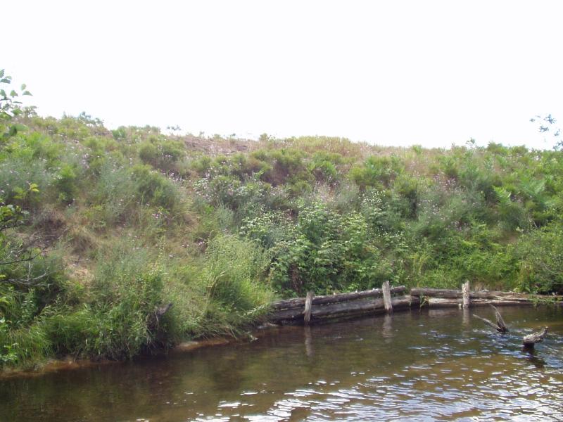
Bank Details
Which Bank? Left
Condition:Toe is stable; upper bank eroding
Erosion Trend:Increasing
Percent Veg. Cover: 50-100%
Bank Conditions
Stream Width:35 ft.
Stream Depth:3 in.
Stream Current:Moderate
Eroded Bank Length:35 ft.
Eroded Bank Height:18 ft.
Slope of Eroded Bank:1:1
Texture: Sand
Cause(s) of Erosion
-Bank seepage
-Foot traffic
Recommended Treatment(s)
-Bank revegetation
-Cover structure
Other Treatments:Coconut fiber rolls, Filter Fabric
General Information
Cribbing is beginning to fail
Total Points
28
�