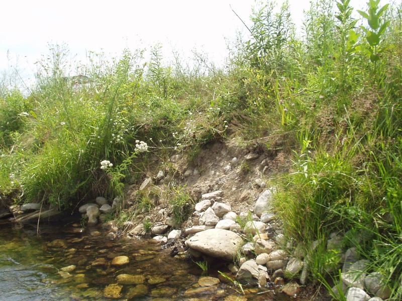
Stream Bank Erosion Site BRD-S498
Total Severity: Moderate
Total Points: 29
Information collected by:
Boardman River Watershed,
Boardman River
Union Twp,
Grand Traverse County
GPS Coordinates: 44.65667219
, -85.43696575
T26N
R9W
Sec 18
Owned by Private
Bank Details
Which Bank? Left
Condition:Toe eroding; upper bank is stable
Erosion Trend:Increasing
Percent Veg. Cover: 0-10%
Bank Conditions
Stream Width:36 ft.
Stream Depth:30 in.
Stream Current:Moderate
Eroded Bank Length:6 ft.
Eroded Bank Height:3 ft.
Slope of Eroded Bank:1:1
Texture: Gravel
Cause(s) of Erosion
-Foot traffic
Recommended Treatment(s)
-Constructed access
General Information
This site includes the Brown Bridge Road stream crossing downstream. Sand is filling up on the bridge surface and the pavement should be extended up Ranch Rudolf Road hill.
Total Points
29

