Stream Bank Erosion Site BRD-S535
Total Severity: Minor
Total Points: 27
Information collected by:
Boardman River Watershed,
Boardman River
East Bay Twp,
Grand Traverse County
GPS Coordinates: 44.65072167
, -85.474795
T26N
R10W
Sec 13
Owned by Private
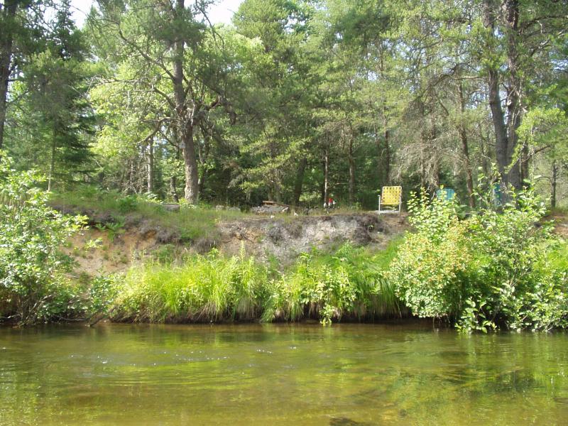
Bank Details
Which Bank? Right
Condition:Toe is stable; upper bank eroding
Erosion Trend:Increasing
Percent Veg. Cover: 50-100%
Bank Conditions
Stream Width:36 ft.
Stream Depth:18 in.
Stream Current:Moderate
Eroded Bank Length:50 ft.
Eroded Bank Height:10 ft.
Slope of Eroded Bank:Vertical
Texture: Sand
Cause(s) of Erosion
-Bend in river
-Foot traffic
Recommended Treatment(s)
-Bank revegetation
-Constructed access
General Information
work with property owner
Total Points
27
�