Stream Bank Erosion Site BRD-S740
Total Severity: Minor
Total Points: 24
Information collected by:
Boardman River Watershed,
North Branch Boardman River
Kalkaska Twp,
Kalkaska County
GPS Coordinates: 44.70759606
, -85.22409953
T27N
R8W
Sec 25
Owned by State
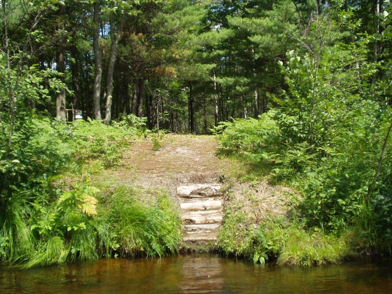
Site Access:Yes - campsite atop bank
Bank Details
Which Bank? Right
Condition:Both toe and upper bank eroding
Erosion Trend:Increasing
Percent Veg. Cover: 10-50%
Bank Conditions
Stream Width:26 ft.
Stream Depth:20 in.
Stream Current:Moderate
Eroded Bank Length:3 ft.
Eroded Bank Height:4 ft.
Slope of Eroded Bank:2:1
Texture: Sand
Cause(s) of Erosion
-Foot traffic
Recommended Treatment(s)
-Constructed access
Other Treatments:diversion birm for storm water runoff
General Information
Users have built log steps into bank which is helping to keep foot traffic problems to a minimum
State campsite
During rain, sheet flow runs from camp area down the bank and into the river.
State campsite
During rain, sheet flow runs from camp area down the bank and into the river.
Total Points
24
�