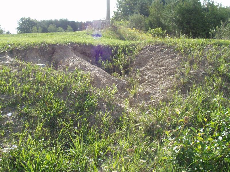
Stream Bank Erosion Site BRD-S290
Total Severity: Minor
Total Points: 20
Information collected by:
Boardman River Watershed,
Kids Creek
Garfield Twp,
Grand Traverse County
GPS Coordinates: 44.74311752
, -85.64160248
T27N
R11W
Sec 16
Owned by Private
Site Access:Yes
Bank Details
Which Bank? Right
Condition:Toe is stable; upper bank eroding
Erosion Trend:Stable
Percent Veg. Cover: 50-100%
Bank Conditions
Stream Width:7 ft.
Stream Depth:6 in.
Stream Current:Moderate
Eroded Bank Length:5 ft.
Eroded Bank Height:30 ft.
Slope of Eroded Bank:2:1
Texture: Sand
Cause(s) of Erosion
-Gullying
Recommended Treatment(s)
-Rock riprap
General Information
Sediments are currently not reaching the river... potential erosion site.
Upper bank is eroding into the gully from new construction on top of the hill.
Upper bank is eroding into the gully from new construction on top of the hill.
Total Points
20

