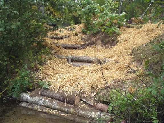
Stream Bank Erosion Site BRD-S355
Total Severity: Restored
Total Points: 20
Information collected by:
Boardman River Watershed,
North Branch Boardman River
Kalkaska Twp,
Kalkaska County
GPS Coordinates: 44.69833718
, -85.25266037
T27N
R8W
Sec 35
Owned by State
Site Access:Yes
Bank Details
Which Bank? Left
Erosion Trend:Stable
Percent Veg. Cover: 50-100%
Bank Conditions
Stream Width:36 ft.
Stream Depth:18 in.
Stream Current:Moderate
Eroded Bank Length:14 ft.
Eroded Bank Height:12 ft.
Slope of Eroded Bank:1:1
Texture: Sand
Cause(s) of Erosion
-Foot traffic
Recommended Treatment(s)
General Information
Some minor foot traffic on upstream side of cribbing/steps.
BMPs Completed:
cribbing/steps
plantings
plantings
Total Points
20
�