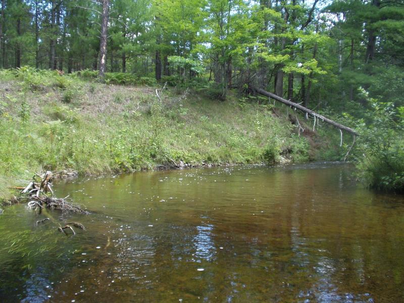
Stream Bank Erosion Site BRD-S379
Total Severity: Moderate
Total Points: 31
Information collected by:
Boardman River Watershed,
North Branch Boardman River
Kalkaska Twp,
Kalkaska County
GPS Coordinates: 44.70297753
, -85.28995255
T27N
R8W
Sec 28
Owned by Private
Bank Details
Which Bank? Right
Condition:Both toe and upper bank eroding
Erosion Trend:Increasing
Percent Veg. Cover: 50-100%
Bank Conditions
Stream Width:25 ft.
Stream Depth:36 in.
Stream Current:Moderate
Eroded Bank Length:16 ft.
Eroded Bank Height:12 ft.
Slope of Eroded Bank:Vertical
Texture: Sand
Cause(s) of Erosion
-Bend in river
Recommended Treatment(s)
-Tree revetments
General Information
Upstream end eroding
Downstream - BMPs holding as designed
Downstream - BMPs holding as designed
BMPs Completed:
rock rip rap
shaping
plantings
topsoil
woody debris
shaping
plantings
topsoil
woody debris
Total Points
31
�