Stream Bank Erosion Site BRD-S380
Total Severity: Severe
Total Points: 37
Information collected by:
Boardman River Watershed,
North Branch Boardman River
Kalkaska Twp,
Kalkaska County
GPS Coordinates: 44.70307255
, -85.2913726
T27N
R8W
Sec 28
Owned by Private
Bank Details
Which Bank? Right
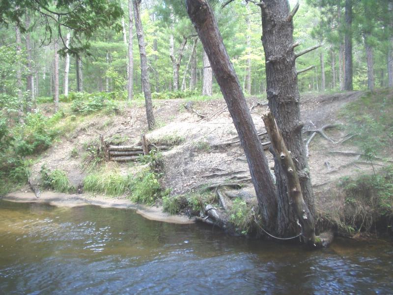
Condition:Both toe and upper bank eroding
Erosion Trend:Increasing
Percent Veg. Cover: 0-10%
Bank Conditions
Stream Width:25 ft.
Stream Depth:36 in.
Stream Current:Fast
Eroded Bank Length:25 ft.
Eroded Bank Height:12 ft.
Slope of Eroded Bank:1:1
Texture: Sand
Cause(s) of Erosion
-Foot traffic
Recommended Treatment(s)
-Bank revegetation
-Rock riprap
-Cover structure
-Constructed access
Other Treatments:Filter fabric
General Information
Cribbing is ineffective, foot traffic is going around.
Either platform or lunker structures between downstream end of site and large trees upstream of site.
Either platform or lunker structures between downstream end of site and large trees upstream of site.
BMPs Completed:
cribbing
Total Points
37
�