Stream Bank Erosion Site BRD-S388
Total Severity: Moderate
Total Points: 28
Information collected by:
Boardman River Watershed,
North Branch Boardman River
Kalkaska Twp,
Kalkaska County
GPS Coordinates: 44.69997311
, -85.25933902
T27N
R8W
Sec 27
Owned by State
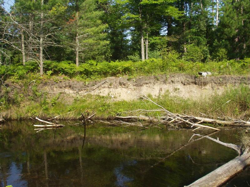
Bank Details
Which Bank? Right
Condition:Toe is stable; upper bank eroding
Erosion Trend:Increasing
Percent Veg. Cover: 10-50%
Bank Conditions
Stream Width:30 ft.
Stream Depth:36 in.
Stream Current:Slow
Eroded Bank Length:40 ft.
Eroded Bank Height:8 ft.
Slope of Eroded Bank:Vertical
Texture: Sand
Cause(s) of Erosion
-Bend in river
Recommended Treatment(s)
-Bank revegetation
-Tree revetments
Other Treatments:Monitor this site
General Information
50 feet at downstream end has stabilized.
BMPs Completed:
whole tree revetments
Total Points
28
�