Stream Bank Erosion Site BGMN-057
Total Severity: Severe
Total Points: 38
Information collected by:
Big Manistee River Watershed,
Hanover Twp,
Wexford County
GPS Coordinates: 44.46366
, -85.62132
T24N
R11W
Sec 22
Owned by State
Bank Details
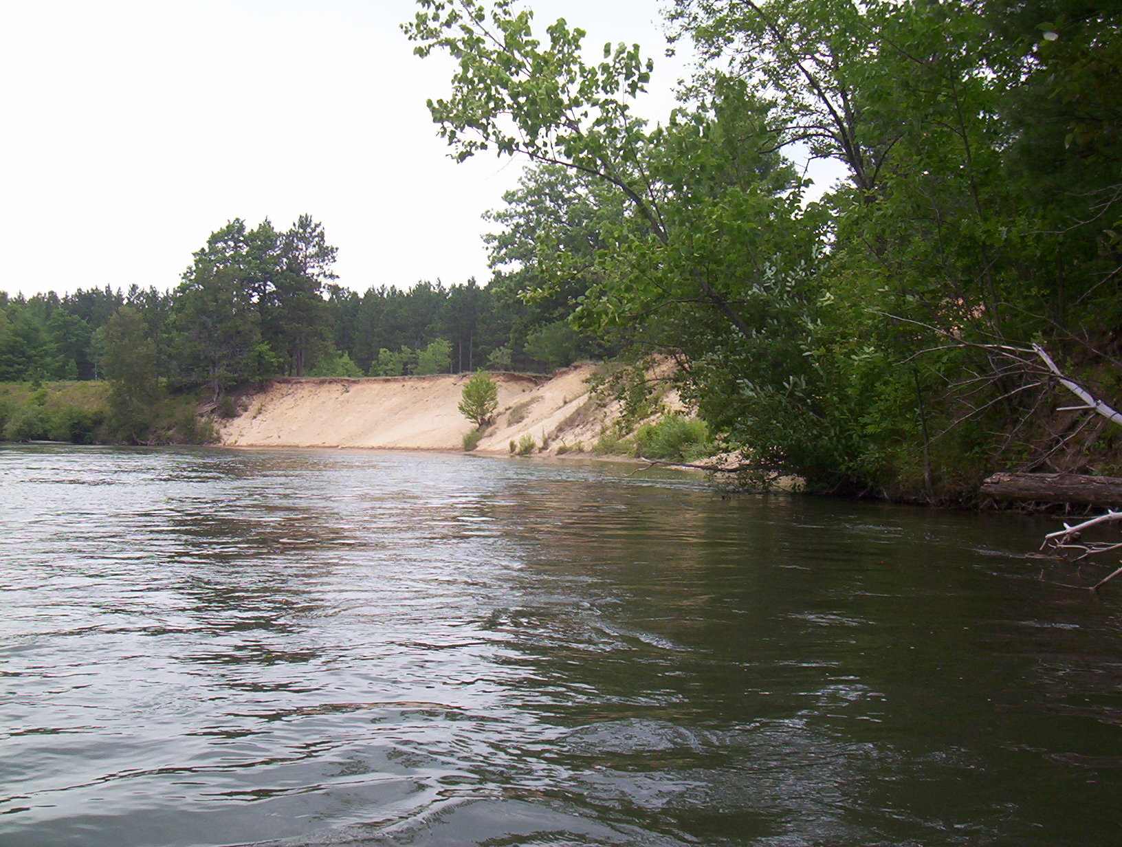
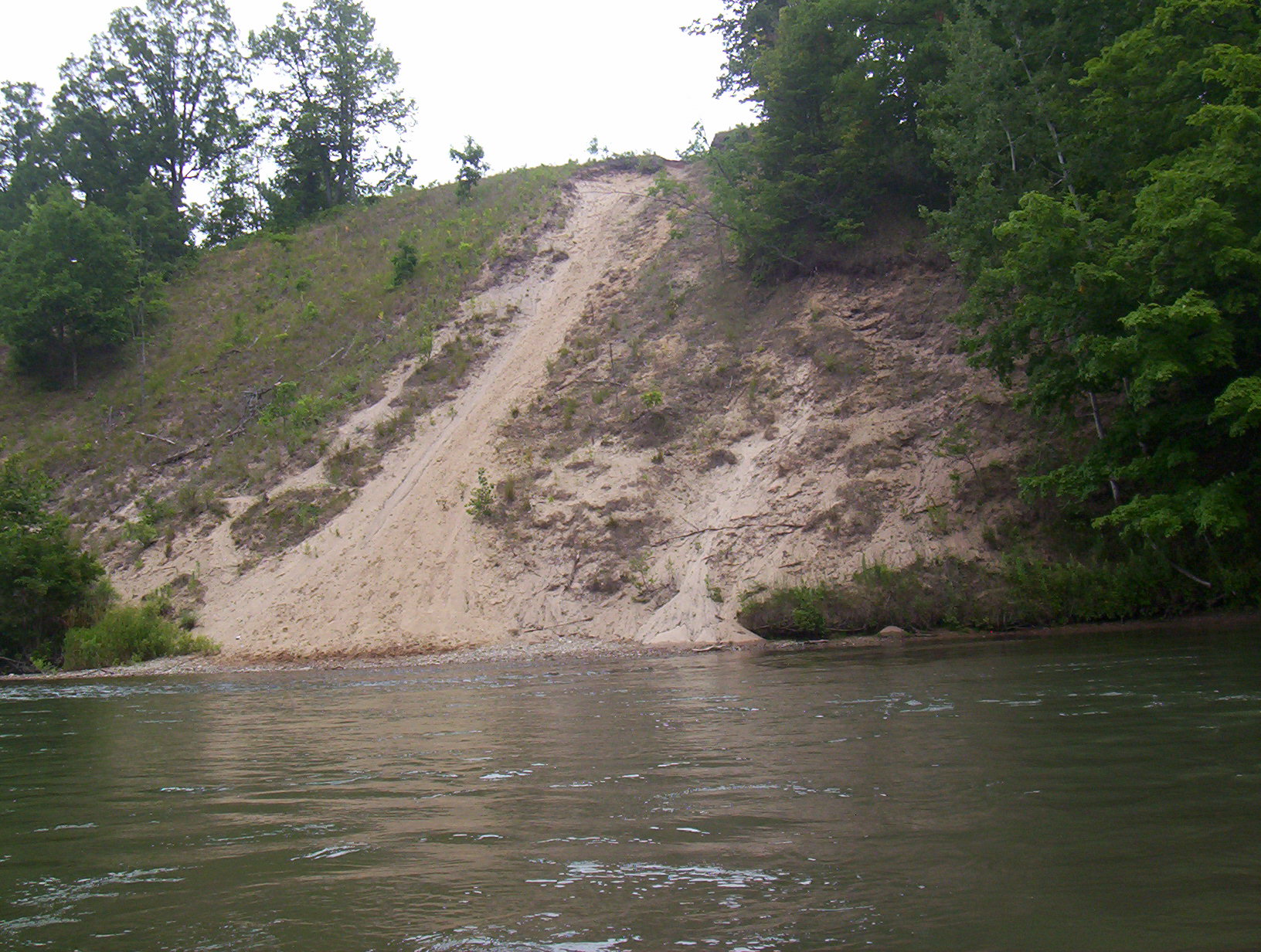
Which Bank? Right
Bank Aspect:SE
Condition:Both toe and upper bank eroding
Erosion Trend:Increasing
Percent Veg. Cover: 0-10%
Bank Conditions
Stream Width:80 ft.
Stream Depth:4 ft.
Stream Current:Fast
Eroded Bank Length:80 ft.
Eroded Bank Height:60 ft.
Slope of Eroded Bank:3:1
Texture: Sand
Cause(s) of Erosion
-Bend in river
-Foot traffic
Recommended Treatment(s)
-Bank revegetation
-Rock riprap
-Constructed access
General Information
Total Points
38
�