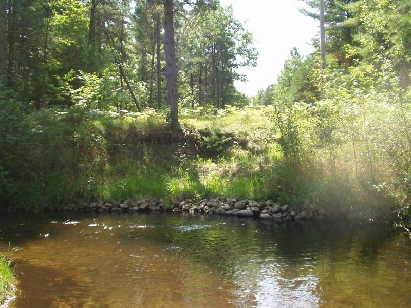
Stream Bank Erosion Site BRD-S775
Total Severity: Restored
Total Points: 20
Information collected by:
Boardman River Watershed,
North Branch Boardman River
Kalkaska Twp,
Kalkaska County
GPS Coordinates: 44.70395671
, -85.27451227
T27N
R8W
Sec 28
Owned by Private
Site Access:Yes - power line
Bank Details
Which Bank? Left
Erosion Trend:Stable
Percent Veg. Cover: 50-100%
Bank Conditions
Stream Width:18 ft.
Stream Depth:48 in.
Stream Current:Moderate
Eroded Bank Length:20 ft.
Eroded Bank Height:8 ft.
Slope of Eroded Bank:1:1
Texture: Sand
Cause(s) of Erosion
-Bend in river
Recommended Treatment(s)
General Information
Power line crossing, restoration looking great!
BMPs Completed:
lunker structures
rock rip rap
rock rip rap
Total Points
20
�