Stream Bank Erosion Site BRD-S777
Total Severity: Severe
Total Points: 33
Information collected by:
Boardman River Watershed,
North Branch Boardman River
Kalkaska Twp,
Kalkaska County
GPS Coordinates: 44.70322274
, -85.28013497
T27N
R8W
Sec 28
Owned by Private
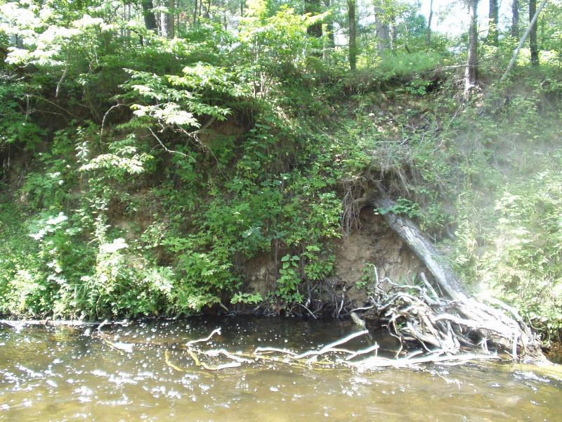
Bank Details
Which Bank? Left
Condition:Both toe and upper bank eroding
Erosion Trend:Increasing
Percent Veg. Cover: 50-100%
Bank Conditions
Stream Width:15 ft.
Stream Depth:36 in.
Stream Current:Moderate
Eroded Bank Length:25 ft.
Eroded Bank Height:18 ft.
Slope of Eroded Bank:Vertical
Texture: Sand
Cause(s) of Erosion
-Bend in river
Recommended Treatment(s)
-Tree revetments
General Information
Elimination of woody debris over time has exposed this site.
Healthy poison ivy...
Healthy poison ivy...
Total Points
33
�