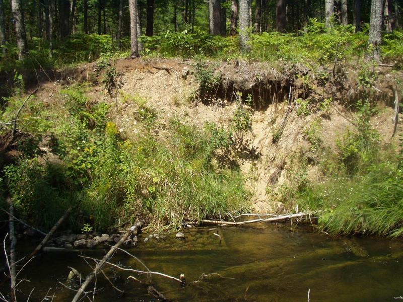
Stream Bank Erosion Site BRD-S779
Total Severity: Severe
Total Points: 34
Information collected by:
Boardman River Watershed,
North Branch Boardman River
Kalkaska Twp,
Kalkaska County
GPS Coordinates: 44.7035006
, -85.28444332
T27N
R8W
Sec 28
Owned by State
Bank Details
Which Bank? Right
Condition:Both toe and upper bank eroding
Erosion Trend:Increasing
Percent Veg. Cover: 0-10%
Bank Conditions
Stream Width:15 ft.
Stream Depth:36 in.
Stream Current:Moderate
Eroded Bank Length:6 ft.
Eroded Bank Height:10 ft.
Slope of Eroded Bank:Vertical
Texture: Sand
Cause(s) of Erosion
-Bend in river
-Foot traffic
Recommended Treatment(s)
-Bank revegetation
-Rock riprap
General Information
Old lunker structure is exposed, drive anchoring rods deeper or remove.
BMPs Completed:
lunker structure
rock rip rap
rock rip rap
Total Points
34
�