Stream Bank Erosion Site BRD-S780
Total Severity: Severe
Total Points: 38
Information collected by:
Boardman River Watershed,
North Branch Boardman River
Kalkaska Twp,
Kalkaska County
GPS Coordinates: 44.70396267
, -85.28693761
T27N
R8W
Sec 28
Owned by State
Site Access:Yes
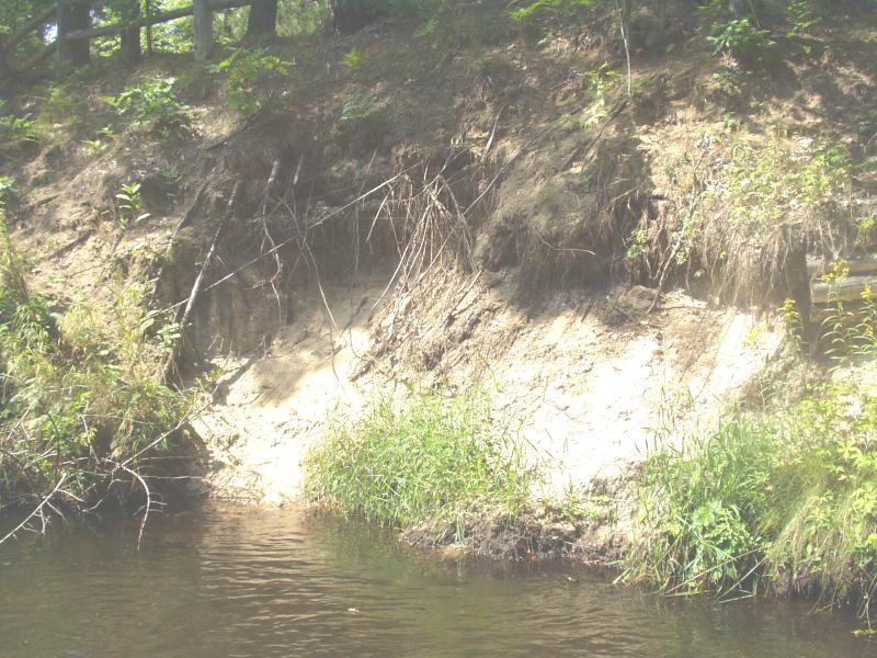
Bank Details
Which Bank? Right
Condition:Both toe and upper bank eroding
Erosion Trend:Increasing
Percent Veg. Cover: 0-10%
Bank Conditions
Stream Width:18 ft.
Stream Depth:40 in.
Stream Current:Moderate
Eroded Bank Length:30 ft.
Eroded Bank Height:20 ft.
Slope of Eroded Bank:Vertical
Texture: Sand
Cause(s) of Erosion
-Bend in river
-Foot traffic
Recommended Treatment(s)
-Bank revegetation
-Rock riprap
-Cover structure
-Constructed access
General Information
This site will need a backhoe.
Old cribbing has given out under heavy foot traffic.
Old cribbing has given out under heavy foot traffic.
BMPs Completed:
fencing
cribbing
cribbing
Total Points
38
�