Stream Bank Erosion Site BRD-S784
Total Severity: Moderate
Total Points: 29
Information collected by:
Boardman River Watershed,
North Branch Boardman River
Kalkaska Twp,
Kalkaska County
GPS Coordinates: 44.70337971
, -85.28761278
T27N
R8W
Sec 28
Owned by State
Private
Private
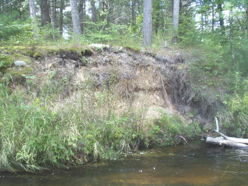
Bank Details
Which Bank? Left
Condition:Both toe and upper bank eroding
Erosion Trend:Increasing
Percent Veg. Cover: 50-100%
Bank Conditions
Stream Width:20 ft.
Stream Depth:30 in.
Stream Current:Moderate
Eroded Bank Length:10 ft.
Eroded Bank Height:8 ft.
Slope of Eroded Bank:Vertical
Texture: Sand
Cause(s) of Erosion
-Bend in river
Recommended Treatment(s)
-Bank revegetation
-Rock riprap
-Cover structure
-Tree revetments
General Information
Middle of bank has a stable toe.
Add woody debris between this site and upstream site S783.
Add woody debris between this site and upstream site S783.
Total Points
29
�